FEMA Flood Map Service Center: Search By Address
Whether you are in a high risk zone or not, you may need flood insurance because most homeowners insurance doesn't cover flood damage. If you live in an area with low or moderate flood risk, you are 5 times more likely to experience flood than a fire in your home over the next 30 years. For many, a National Flood Insurance Program's flood insurance policy could cost less than $400 per year. Call your insurance agent today and protect what you've built.
Learn more about steps you can take to reduce flood risk damage.
Search Results—Products for
The flood map for the selected area is numberflood map number, effective oneffective date![]()
Dynamic Map

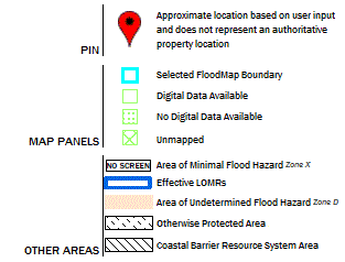
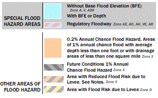
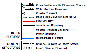
Map Image


Failed to load Map Image. Please try refreshing the page.
Changes to this FIRM 
Revisions (0)
Amendments (0)
Revalidations (0)
You can choose a new flood map or move the location pin by selecting a different location on the locator map below or by entering a new location in the search field above. It may take a minute or more during peak hours to generate a dynamic FIRMette.
You can choose a new flood map or move the location pin by selecting a different location on the locator map below or by entering a new location in the search field above. It may take a minute or more during peak hours to generate a dynamic FIRMette.